



Queen Elizabeth Islands Ice Caps & Plateaus Real-World Terrains 264 km²
Matei Ioan Alexandru
$19.24
$27.49
30%OFF
(no ratings)
Jump AssetStore
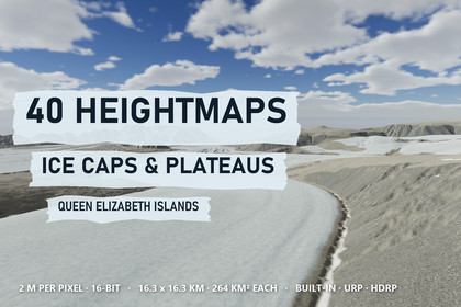
40 maps of Arctic ice caps, plateaus, nunataks and outlet glaciers at 2 m (264 km² each) as true-scale Unity terrains. 9 demo scenes, all pipelines.Unity 2022.3 and above. Demo scenes for Built-in, URP and HDRP are included; the Shore Water Setup window turns on the depth texture URP needs for the meltwater lake.▶ The ice caps on video, in 4K: https://youtu.be/XNg0Y3AhmmkIce caps, plateaus and outlet glaciers of the Queen Elizabeth Islands - 40 real-world maps for UnitySmooth upland domes, plateau margins broken by deep valleys, nunataks standing out of the ice, and outlet glaciers that join and flow down to the lowlands. Made from LiDAR elevation data at 2 m per pixel; each of the 40 maps covers 16.26 x 16.26 km (264 km²) and 855 m to 1,500 m of relief.✦ CONTENTS40 heightmaps of ice-cap country - 16-bit PNG, 8129 x 8129 px, size and height range in the file nameTerrains at true scale - 2 x 2 Unity terrains of 4097 samples per map from the original pixels, lowest point at Y = 0Three demo levels - Glacier Confluence, Outlet Glacier and Ice Cap Nunataks in Built-in, URP and HDRPGlacier ice on the terrain - firn above the firn line, bare ice below, painted where the data shows iceA meltwater lake - Shore Water with soft shorelines on Glacier Confluence✦ ICE AND ROCKEight 4K layers - plateau gravel, tundra crust, meltwater silt, dark talus, bedded dolomite, moraine, firn and glacier iceMoraine on the valley glaciers - bands of debris follow the rough ice; the smooth ice caps stay cleanDolomite plateau edges - soft bands of bedded rock on the cliffs, dark talus at their feetAnti-tiling shaders - three texture scales and four scales of variation keep the wide ice and gravel plains free of patterns✦ SPEEDNative 3840 x 2160 on an RTX 3090 - HDRP 108-149 FPS · URP 111-180 FPS · Built-in 107-399 FPS, no upscaling✦ COMPATIBILITYUnity 2022.3 and above; Built-in, URP and HDRP. One click in Project Setup switches on the terrain holes the builder uses. In Built-in the demo levels run without post-processing and look plainer.✦ WHERE IT FITSPolar survival and expedition games, glacier flights, open-world ice fields, cinematic establishing shots and glaciology visuals.✦ THE SERIESFjords & Coasts - the coast the glaciers reach - https://assetstore.unity.com/packages/slug/427610Mountains & Ridges - the ranges between the ice caps - https://assetstore.unity.com/packages/slug/427612Polar Desert Lowlands - the dry country beyond the ice - https://assetstore.unity.com/packages/slug/427616The 40 maps do not repeat ground from any other pack of this seller.Data - 40 heightmaps, 16-bit PNG, 8129 x 8129 px at 2 m per pixel - 264 km² per mapRelief range - 855 m to 1,500 mTerrain layout - 2 x 2 terrains of 4097 samples, the original pixels, edge strip removed with holesVertical step - 26.1 to 45.8 mm per height levelScenes - Glacier Confluence, Outlet Glacier, Ice Cap Nunataks x Built-in / URP / HDRP; 3 prefabsLayers - 8 Ice Caps and Plateaus layers + shared layers, 4096 px albedo with smoothness, normal and mask mapsIce - firn line, bare ice and moraine bands painted from the dataWater - Shore Water lake surface coloured by depth (Glacier Confluence)Shaders - hex-tile anti-tiling, side projection on cliffs, dolomite beds, plane-mapped detail reliefIncluded tools - Terrain Builder, Project Setup, Shore Water Setup, Arctic Ground Textures, PDF guideEngine - Unity 2022.3 and above