



Real Ground - 56 Terrain Ground Types, Splat Shader & Real Water (URP)
u3d
$11.00
$22.00
50%OFF
(no ratings)
Jump AssetStore
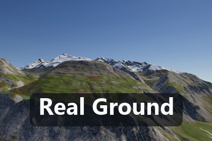
Every kind of ground for Unity 6 URP terrains: 56 PBR ground types, a 16-layer splat shader, a climate classifier that paints them, and Real Water with 27 regional water colours.URP only: built and tested on Unity 6000.3.21f1 with URP 17.3 (Universal 3D template). Built-in RP and HDRP are not supported. Shader Model 4.5 (texture arrays); Real Water needs the URP Opaque and Depth textures for refraction and shallows.Paint believable ground on any Unity terrain: 56 physically described ground types, from chernozem and laterite to scree, lava, salt flats, rice paddies, firn and glacier ice, painted by climate, slope and wetness and drawn by a 16-layer splat shader that does not tile at any distance. Includes Real Water: rivers, lakes and seas coloured by their region. Universal Render Pipeline (URP) for Unity 6.3 (6000.3.21f1).56 ground types, each with its own textures- Soils, sands, gravels, rocks by lithology (granite, gneiss, slate, red sandstone, karst limestone, basalt), volcanic ground (aa and pahoehoe lava, cinders, ash, black sand), litter, grassland (meadow, steppe, puna, savanna), wetland (bog, mangrove and tidal mud), crops (ploughed field, stubble, rice paddy), snow, firn and glacier ice.- Every type is a Unity Terrain Layer with albedo, normal and mask maps (2048 or 1024 pixels; 168 maps in all), seamless without a visible 2 x 2 repeat, plus physical parameters and habitat rules (climate zones, Koeppen classes, lithology, altitude belt, slope, temperature, precipitation, wetness).A splat shader made for big terrains- Real Ground/Terrain for Unity Terrain and mesh terrains: up to 16 layers in one pass through texture arrays, height blending by each type's height contrast, triplanar cliffs, hex anti-tiling with near and far UV scales.- One shared 3D noise (RealNoise) shifts hue and brightness at four scales and blends far looks of every layer, so the tile repeat is broken from metres to kilometres. Field furrows follow the direction of each parcel and blur into their mean in the distance instead of forming a stripe grid.- Overlays from data: snow and firn line, snow fields with thaw holes, wetness, puddles and road dust from an RGBA mask.Painted by climate, not by hand- GroundSurface on a Terrain: choose up to 16 types and a climate, press Paint, then Apply. The classifier reads height, slope, insolation, a topographic wetness index, annual temperature, precipitation, a degree-day snowpack and lithology.- Bring your own data through IGroundInputs and your own rules through IGroundClassifier; GroundPainter.Result reports the dominant type per texel and the painted share of every layer.Real Water included- The shader Real Ground/Water colours water from its optics: 27 optical water classes (open-ocean and coastal Jerlov types, carbonate shelf, mangrove estuary, karst turquoise, glacial river and lake, humic and blackwater, loess, laterite and volcanic sediment, eutrophic, saline), computed from published optical constants with exact per-channel Beer-Lambert transmittance.- RealWaterRules picks and mixes the class from climate, Koeppen zone, lithology, the ground types of the catchment and the month: red rivers in the rainy season, clear green water in the dry season, snowmelt, ice.- Soft banks and shallows that show the real shore through the water, surf along the depth contours, reflections of the place captured once, no visible ripple tiling on large water. River meshes with depth and flow from WaterMesh.19 sample scenes- A generated alpine valley, nine places on real relief (Swiss Alps, Hunsrueck fields, Kruger savanna, Las Terrenas coast, Nordkapp tundra, Peruvian puna, Salar de Uyuni, Vinales karst, Wadi Rum desert) and nine Real Water scenes, from the Niger at Niamey to a frozen river in Yakutia.AI Ready. Built to be driven by AI coding agents as well as by hand. Documentation/AGENTS.md gives Claude Code, Codex, Cursor or a Unity MCP bridge the exact entry points: the GroundSurface and WaterSurface components, GroundPainter, TerrainGroundInputs and RealWaterRules in C#, the 56 ground types and 27 water classes as plain data (catalogue JSON, climate presets as ScriptableObjects), the Tools > Real Ground menu commands, five task recipes, and a verification step (Tools > Real Ground > Validate Installation or GroundValidate.RunBatch prints RG|VERIFY|PASS types=56 layers=56 shaders=3 waterClasses=27), so an agent can paint, tune and check terrain ground without guessing.Honest limits- URP 17.3 only. Built-in RP and HDRP are not supported.- Shader Model 4.5 (texture arrays). Tested on Windows desktop (Editor and player); WebGL 2 uses 512-pixel arrays; no tests on phones or consoles.- Up to 16 ground types per terrain. The ground types are textures and rules: there are no rock or plant meshes in this package.- Real Water needs a water mesh with depth in its second UV channel (WaterMesh builds one); refraction and screen-space reflections need the URP Opaque and Depth textures.Textures and data- 49 ground types use original AI-generated images made for this package (see the AI disclosure), converted to seamless PBR maps by the publisher's own tools; one lava type is fully procedural and six base layers come from the publisher's Houdini recipes. No photographs, scans or third-party textures.- Water colours are computed from published measurements. The sample scenes use open elevation data (Copernicus DEM GLO-30, Terrain Tiles), OpenStreetMap land use and waterways (© OpenStreetMap contributors, ODbL) and open climate data, credited in Documentation/THIRD-PARTY-NOTICES.md.SupportQuestions and bug reports: cgteamorg@gmail.com. Please include your Unity version and the lines that start with RG|VERIFY|.If Real Ground helps your project, a rating on the Asset Store helps other developers find it. It is optional, and nothing depends on it.More from this family- Real Earth Planet — real-world terrain, roads and railways generator (its 1.2 regions are drawn with Real Ground): https://assetstore.unity.com/packages/slug/412072- Real Roads & Tracks — roads, railways and coasters: https://assetstore.unity.com/packages/slug/411734- Unity 6000.3.21f1 (Unity 6.3), Universal Render Pipeline 17.3. HDRP and Built-in are not supported.- Package root Assets/RealGround: Runtime (assembly RealGround.Runtime), Editor (RealGround.Editor), Shaders, Resources, Samples, Documentation.- 56 ground types = 56 Terrain Layers, 168 PNG maps (albedo, normal, mask; 100 at 2048 px, 65 at 1024 px, 3 at 512 px).- Shaders: Real Ground/Terrain (16 layers via Texture2DArray, Shader Model 4.5), Real Ground/Water, a hidden packing shader. Compiled without errors for Metal, Vulkan, OpenGL Core and GLES 3 (plus D3D11 in the editor).- Real Water: 27 optical classes and 34 selection rules (JSON data in Resources/RealGround/Water).- 19 sample scenes (10 ground, 9 water) with their terrain, overlay and climate data.- Package size: 1.11 GB (1 196 533 227 bytes).- Documentation: Manual.md, AGENTS.md (AI agents), CHANGELOG.md, THIRD-PARTY-NOTICES.md.- No dependencies outside Unity's own packages (URP, Terrain module, JSON serialization).Yes. The ground textures of 49 of the 56 ground types were generated with the image model Krea 2 Turbo on the publisher's own machines from the publisher's own prompts and seeds, upscaled with ESRGAN, and converted to seamless PBR maps (albedo, normal, mask, height) by the publisher's own deterministic tools. No AI was used for the other seven: the Pahoehoe lava maps are fully procedural, and six base layers (lush meadow, loam soil, generic rock, beige sand, fresh snow, river gravel) come from the publisher's own Houdini material recipes. No photographs, scans or third-party textures are included. The C# code, shaders and documentation were written with the help of AI coding assistants and reviewed by the publisher. The water colours are computed from published optical measurements, not generated.