



England Chalk Downs Real-World Terrains 16 km²
Matei Ioan Alexandru
$15.39
$21.99
30%OFF
(no ratings)
Jump AssetStore
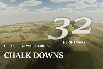
32 real-world maps of chalk downs in Dorset, Hampshire and Sussex, 4 x 4 km (16 km²) each at 1 m, 1:1 scale. 9 demo scenes, Built-in/URP/HDRP.Unity 2022.3 and above. Built-in, URP and HDRP in one package. Real-scale terrains (1 unit = 1 m) built from the exact heightmap pixels.▶ Full 4K video showcase: https://www.youtube.com/watch?v=SvPf6tNA5yUChalk downland of Dorset, Hampshire and Sussex - scarps, coombes, dry valleys and rolling downs at their real size, 4 x 4 km per map at 1 m32 maps of the chalk downland of Dorset, Hampshire and Sussex, made from real-world elevation data (LiDAR DTM, 1 m). Rolling downs cut by dry valleys, steep scarp faces with coombes, long chalk ridges above the vales, harvested fields on the gentle slopes and white chalk in pits and scars - with up to 220 m of relief on a single map. Each map covers 4.03 x 4.03 km (about 4 x 4 km, 16 square km) at 1 m between samples. Every Unity terrain sample is an original heightmap pixel - nothing is stretched or resampled - and 1 Unity unit is 1 metre.✦ WHAT'S INSIDE32 heightmaps - 16-bit PNG, 4033 x 4033 px, relief from 67 m to 220 m per mapOne Unity terrain per map - one terrain of 4097 samples per map; the unused 64-sample edge strip is cut away with terrain holes, lowest point at Y = 03 demo levels x 3 render pipelines - 9 ready scenes to fly or walk through: Downs Scarp, Ridge and Vale, Steep CoombesTerrain Builder - one click turns any heightmap into a real-scale Unity terrainChalk Downland ground look - 8 ground layers in 4K: chalk turf, woodland ground, stubble, chalk rubble, chalk, flint gravel, scrub ground, pastureLate summer on the chalk downs - the ground of the demo levels is painted from the real shape of each map at 1 m: gold-green chalk turf on the steep unploughed slopes, stubble on the harvested fields, scrub ground and woodland ground on the scarps and in the coombes, chalk rubble where the slopes break, white chalk in the pits and scars and pasture on the valley floors✦ DOWNLAND GROUNDNo visible tiles or seams - every layer is read with hex-tile stochastic sampling at three sizes, aligned to the world and blended by viewing distance, with ground variation at four sizes on top - no repeating pattern up close, in the middle distance or from the air, and no seams between terrainsChalk beds with flint bands - each demo map has its own bed table that the terrain shader reads, so chalk pits and scars show level beds with darker flint bandsPainted from the real shape at 1 m - slope separates the steep unploughed turf from the gentle arable ground, the 1 m data finds the field parcels and their boundaries, the map's own drainage finds the dry valleys and coombes, and the scarp edges get chalk rubbleFine surface relief - lumps and hollows finer than the height data on the near ground, plane-mapped so they never stretch down steep faces, fading out with distance✦ FEATURESReal-world maps at 1 m - 4 x 4 km (16 km²) of real ground per map, at 1 m between samples: scarps, coombes, dry valleys, chalk ridges, field parcels and river valleys are in the data itselfExact scale - size and height range are in every file name and inside every PNG, and the builder reads them for youSteep faces without stretching - textures are projected from the side on steep faces, so tors, scarps and quarry walls show real rock texture instead of vertical streaks; flat ground is unchangedVerify - compares every terrain height with the original pixels✦ PERFORMANCENative 3840 x 2160 - no upscaling, demo scenes in player builds: HDRP 117-145 FPS · URP 94-110 FPS · Built-in 187-225 FPS (RTX 3090)✦ DEMO CONTROLSMouse look · WASD move · Shift fast · G walk at 1.8 m eye height · F fly · N / P next / previous level · H help✦ UNITY 2022.3 AND ABOVEBuilt-in, URP and HDRP in one package. Tools > Lidar Terrains > Project Setup switches on terrain holes, and Shore Water Setup the depth and opaque textures the water reads, in your pipeline asset with one click. The Built-in Render Pipeline has no post-processing, so the Built-in demo levels look simpler than the URP and HDRP ones.✦ USE CASESOpen-world games · walking, flight and driving simulators · survival, exploration and countryside games · cinematics · terrain studies. The heightmaps also work in other tools: 16-bit PNG, north up, size and height range in the file name.✦ THE ENGLAND SERIESFour landscapes of south-west and southern England, four ground looks, every map 4 x 4 km at 1 m:England Granite Moors & Tors - https://assetstore.unity.com/packages/slug/427314England West Country Valleys - https://assetstore.unity.com/packages/slug/427316England Levels, Heaths & Weald - https://assetstore.unity.com/packages/slug/427320No map repeats ground sold in the seller's other packs.✦ MORE REAL-WORLD TERRAINSSame format, same tools:Enormous USA Mountains & Peaks - https://assetstore.unity.com/packages/slug/427174Enormous USA Canyons & Mesas - https://assetstore.unity.com/packages/slug/427178Enormous USA Basins & Plains - https://assetstore.unity.com/packages/slug/427180Grand Canyon Rims & Plateaus - https://assetstore.unity.com/packages/slug/426850Grand Canyon Inner Canyons - https://assetstore.unity.com/packages/slug/426854Grand Canyon-Parashant - https://assetstore.unity.com/packages/slug/426856Lake Mead & Mojave Desert - https://assetstore.unity.com/packages/slug/426858USA Sierra Nevada & Cascades - https://assetstore.unity.com/packages/slug/426148USA Rocky Mountains & Great Plains - https://assetstore.unity.com/packages/slug/426150USA California & Desert Southwest - https://assetstore.unity.com/packages/slug/426152USA Eastern Forests & Lakes - https://assetstore.unity.com/packages/slug/426154UK Fells, Moors & Dales - https://assetstore.unity.com/packages/slug/426156Alaska Mountain Peaks - https://assetstore.unity.com/packages/slug/425664Alaska Valleys & Uplands - https://assetstore.unity.com/packages/slug/425668Alaska Fjords, Lakes & Volcanoes - https://assetstore.unity.com/packages/slug/425670Heightmaps - 32 x 16-bit greyscale PNG, 4033 x 4033 px: 32 maps of 4.03 x 4.03 km (about 4 x 4 km, 16 square km) at 1 m per pixelRelief - 67 m to 220 m per map (lowest point of each map at 0)Unity terrains - one terrain of 4097 samples per map, terrain holes for the exact edgeHeight precision - one height level is about 2.0 mm on the flattest map and about 6.7 mm on the map with the largest height rangeDemo content - 3 map prefabs (one prefab works in every pipeline) + 9 demo scenes (3 per pipeline)Ground textures - Chalk Downland (8 ground layers) + the shared ground layers, 4096 x 4096 albedo with smoothness, normal and maskRock beds - a bed table per demo map, read by the terrain shader in Built-in, URP and HDRPWater - Shore Water: transparent lake surfaces, only on level water of the demo maps (lakes only, no rivers), coloured by the real water depth (depth texture), for Built-in, URP and HDRPShaders - anti-tiling, world-aligned terrain shaders (hex-tile stochastic sampling, three texture sizes blended by viewing distance, ground variation at four sizes) with side projection on steep faces, rock beds and plane-mapped fine relief, for Built-in, URP and HDRPEditor tools - Terrain Builder, Project Setup, Shore Water Setup, England Ground Textures; PDF documentation includedCompatibility - Unity 2022.3 and above; Built-in, URP and HDRP