



Enormous USA Basins & Plains Real-World Terrains 1,626 km²
Matei Ioan Alexandru
$15.39
$21.99
30%OFF
(no ratings)
Jump AssetStore
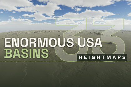
33 real-world maps of sagebrush basins and plains in the western USA, 40 x 40 km (1,626 km²) each at 10 m, 1:1 scale. 9 demo scenes, Built-in/URP/HDRP.Unity 2022.3 and above. Built-in, URP and HDRP in one package. Real-scale terrains (1 unit = 1 m) built from the exact heightmap pixels.▶ Full 4K video showcase: https://youtu.be/5ooqGvzzMU4Sagebrush basins and plains of the western USA - wide basin floors, low ranges, badlands and dry lake beds at their real size, 40 x 40 km per map33 maps of the sagebrush basins and plains of the western USA, made from real-world elevation data (DEM). Wide basin floors of sage and cured grass, low ranges and ridges, clay badlands, dry washes and the pale beds of playas and lakes - with up to 2,268 m of relief on a single map. Each map covers 40.32 x 40.32 km (about 40 x 40 km, 1,626 square km) at 10 m between samples. Every Unity terrain sample is an original heightmap pixel - nothing is stretched or resampled - and 1 Unity unit is 1 metre.✦ WHAT'S INSIDE33 heightmaps - 16-bit PNG, 4033 x 4033 px, relief from 200 m to 2,268 m per mapOne Unity terrain per map - one terrain of 4097 samples per map; the unused 64-sample edge strip is cut away with terrain holes3 demo levels x 3 render pipelines - 9 ready scenes to fly or walk through: Lake Basin, Butte Field, Cone PlainTerrain Builder - one click turns any heightmap into a real-scale Unity terrainSagebrush Basin ground look - 8 ground layers in 4K: sage, cured grass, crusted soil, ledge rock, sandstone blocks, wash gravel, clay badlands, playa / lake bedShore Water - on the real 175 km² lake and two smaller lakes of the Lake Basin demo map - soft shorelines traced on the terrain, in Built-in, URP and HDRPLate summer in the sagebrush basins - the ground of the demo levels is painted from the real shape of each map: sage and cured grass on the open plains, clay badlands on the broken slopes and the pale beds of playas and lakes on the basin floors✦ BASIN GROUNDNo visible tiles or seams - every layer is drawn at three sizes, aligned to the world, and blended by viewing distance - no repeating pattern up close, in the middle distance or from the air, and no seams between terrainsBanded badlands - each demo map has its own bed table that the terrain shader reads, so clay and shale slopes show level bands, as real badlands doPainted from the real shape - height, slope and the map's own drainage decide where each layer lies: sage and grass on the plains, gravel in the washes, playa and lake beds on the lowest flat floorsFine surface relief - lumps and hollows finer than the height data on the near ground, plane-mapped so they never stretch down steep faces, fading out with distance✦ FEATURESEnormous real-world maps - 40 x 40 km (1,626 km²) of real ground per map, at 10 m between samples: wide basin floors, low ranges, ridges, badlands, washes and dry lake beds are in the data itselfExact scale - size and height range are in every file name and inside every PNG, and the builder reads them for youCliffs without stretching - textures are projected from the side on steep faces, so walls show real rock texture instead of vertical streaks; flat ground is unchangedVerify - compares every terrain height with the original pixels✦ PERFORMANCENative 3840 x 2160 - no upscaling, demo scenes in player builds: HDRP 112-149 FPS · URP 117-196 FPS · Built-in 176-408 FPS (RTX 3090)✦ DEMO CONTROLSMouse look · WASD move · Shift fast · G walk at 1.8 m eye height · F fly · N / P next / previous level · H help✦ UNITY 2022.3 AND ABOVEBuilt-in, URP and HDRP in one package. Tools > Lidar Terrains > Project Setup switches on terrain holes, and Shore Water Setup the depth and opaque textures the water reads, in your pipeline asset with one click. The Built-in Render Pipeline has no post-processing, so the Built-in demo levels look simpler than the URP and HDRP ones.✦ USE CASESOpen-world games · flight and driving simulators · survival, exploration and western games · cinematics · terrain studies. The heightmaps also work in other tools: 16-bit PNG, north up, size and height range in the file name.✦ THE ENORMOUS USA SERIESThree landscapes of the western USA, three ground looks, every map 40 x 40 km:Enormous USA Mountains & Peaks - https://assetstore.unity.com/packages/slug/427174Enormous USA Canyons & Mesas - https://assetstore.unity.com/packages/slug/427178No map repeats ground sold in the seller's other packs.✦ MORE REAL-WORLD TERRAINSSame format, same tools:Grand Canyon Rims & Plateaus - https://assetstore.unity.com/packages/slug/426850Grand Canyon Inner Canyons - https://assetstore.unity.com/packages/slug/426854Grand Canyon-Parashant - https://assetstore.unity.com/packages/slug/426856Lake Mead & Mojave Desert - https://assetstore.unity.com/packages/slug/426858USA Sierra Nevada & Cascades - https://assetstore.unity.com/packages/slug/426148USA Rocky Mountains & Great Plains - https://assetstore.unity.com/packages/slug/426150USA California & Desert Southwest - https://assetstore.unity.com/packages/slug/426152USA Eastern Forests & Lakes - https://assetstore.unity.com/packages/slug/426154UK Fells, Moors & Dales - https://assetstore.unity.com/packages/slug/426156Alaska Mountain Peaks - https://assetstore.unity.com/packages/slug/425664Alaska Valleys & Uplands - https://assetstore.unity.com/packages/slug/425668Alaska Fjords, Lakes & Volcanoes - https://assetstore.unity.com/packages/slug/425670Heightmaps - 33 x 16-bit greyscale PNG, 4033 x 4033 px: 33 maps of 40.32 x 40.32 km (about 40 x 40 km, 1,626 square km) at 10 m per pixelRelief - 200 m to 2,268 m per map (lowest point of each map at 0)Unity terrains - one terrain of 4097 samples per map, terrain holes for the exact edgeHeight precision - one height level is about 0.6 cm on the flattest map and about 6.9 cm on the map with the largest height rangeDemo content - 3 map prefabs (one prefab works in every pipeline) + 9 demo scenes (3 per pipeline)Ground textures - Sagebrush Basin (8 ground layers) + the shared ground layers, 4096 x 4096 albedo, normal and maskRock beds - a bed table per demo map, read by the terrain shader in Built-in, URP and HDRPWater - transparent lake surfaces, only on the real lakes of the demo maps, coloured by the real water depth (depth texture), for Built-in, URP and HDRPShaders - anti-tiling, world-aligned terrain shaders (three texture sizes blended by viewing distance) with side projection on steep faces, rock beds and plane-mapped fine relief, for Built-in, URP and HDRPEditor tools - Terrain Builder, Project Setup, Shore Water Setup, Enormous USA Ground Textures; PDF documentation includedCompatibility - Unity 2022.3 and above; Built-in, URP and HDRP