



Norway Real-World LIDAR Terrains 8K
Matei Ioan Alexandru
$19.24
$27.49
30%OFF
(no ratings)
Jump AssetStore
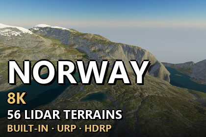
56 real-world LIDAR terrains of Norway, 8.128 x 8.128 km each at 1 m resolution, true 1:1 scale in Unity. 9 demo scenes, Built-in/URP/HDRP.Unity 2022.3 and above. Built-in, URP and HDRP in one package. Real-scale terrains (1 unit = 1 m) built from the exact heightmap pixels.Glacial valleys, alpine lakes, cirque ridges and high mountain plateaus of Norway at their real size56 real-world terrains from LIDAR elevation data. High fjell plateaus, glacial valleys, cirques, ridges and lakes of Norway, with snow on the highest tops. Every heightmap covers 8.128 x 8.128 km (about 8 x 8 km, 64 square km) with 1 m between samples. Every Unity terrain sample is an original heightmap pixel - nothing is stretched or resampled - and 1 Unity unit is 1 metre.✦ GOOD TO KNOWThis pack holds 56 Norway maps. Scotland is a separate collection of 93 maps (two packs, Part 1 and Part 2). No map appears in more than one pack.✦ WHAT'S INSIDE56 heightmaps - 16-bit PNG, 8129 x 8129 px, height range from 261.1 m to 1756.1 m3 demo levels x 3 render pipelines - 9 ready scenes to fly or walk through: Alpine Lakes, Glacial Valley, Cirque RidgesTerrain Builder - one click turns any heightmap into seamless real-scale Unity terrainsNorway fjell ground look - 8 ground layers in 4K (meadow, forest floor, dry earth, scree, rock, gravel, snow, lake bed), painted automatically from slope, landform and heightWater - lakes: mirror lakes that reflect the real mountains, with gently moving ripples and deeper water towards the middle, in Built-in, URP and HDRP✦ FEATURESExact scale - size and height range are in every file name and inside every PNG, and the builder reads them for youAnti-tiling terrain shaders - every layer blends three texture sizes by viewing distance, so no repeating patternsCliffs without stretching - textures are projected from the side on steep faces, so cliffs show real rock texture instead of vertical streaks; flat ground is unchangedSeamless 2 x 2 tiles - each map is split into 4 terrains of 4097 samples (Unity's limit) that share their edge pixelsVerify - compares every terrain height with the original pixels✦ PERFORMANCENative 3840 x 2160 - no upscaling, demo scenes in player builds: Built-in 87-156 FPS · URP 66-107 FPS · HDRP 98-116 FPS (RTX 3090)✦ DEMO CONTROLSMouse look · WASD move · Shift fast · G walk at 1.8 m eye height · F fly · N / P next / previous level · H help✦ UNITY 2022.3 AND ABOVEBuilt-in, URP and HDRP in one package. Tools > Lidar Terrains > Project Setup switches on terrain holes in your pipeline asset with one click.✦ USE CASESOpen-world games · flight and driving simulators · hiking and survival games · cinematics · terrain studies. The heightmaps also work in other tools: 16-bit PNG, north up, size and height range in the file name.Heightmaps - 56 x 16-bit greyscale PNG, 8129 x 8129 px, 1 m sample spacing, 8.128 x 8.128 km (about 8 x 8 km, 64 square km) eachHeight range - 261.1 m to 1756.1 m (lowest point of each map at 0)Unity terrains - 2 x 2 tiles of 4097 samples per map, terrain holes for the exact edgeDemo content - 3 map prefabs (one prefab works in every pipeline) + 9 demo scenes (3 per pipeline)Ground textures - 8 Norway ground layers + the shared ground layers, 4096 x 4096 albedo, normal and maskWater - lakes: mirror lake surfaces with moving ripples and depth shading for Built-in, URP and HDRPShaders - anti-tiling, world-aligned terrain shaders with side projection on steep faces (triplanar) for Built-in, URP and HDRPEditor tools - Terrain Builder, Project Setup, Norway Ground Textures; PDF documentation includedCompatibility - Unity 2022.3 and above; Built-in, URP and HDRP