



Italy Alps & Apennines Real-World Terrains 50 km
Matei Ioan Alexandru
$15.39
$21.99
30%OFF
(no ratings)
Jump AssetStore
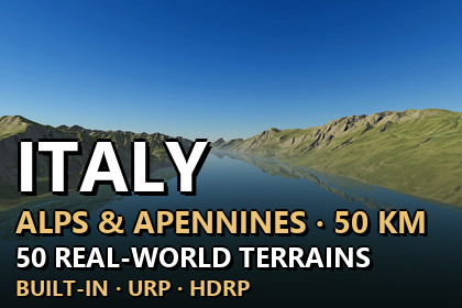
50 real-world heightmaps of Italy, 50.08 x 50.08 km each at 12.42 m resolution, true 1:1 scale in Unity. 9 demo scenes, Built-in/URP/HDRP.Unity 2022.3 and above. Built-in, URP and HDRP in one package. Real-scale terrains (1 unit = 1 m) built from the exact heightmap pixels.▶ Full 4K video showcase: https://youtu.be/wh1n_1Bh3V4Lake Garda, the high Alps, volcanic Lake Bolsena and the Apennines of Italy at their real size50 heightmaps of Italy from real-world elevation data. Lake Garda, Alpine peaks and valleys, volcanic lakes such as Lake Bolsena and the long ridges of the Apennines of Italy, with snow on the highest tops. Each map covers 50.08 x 50.08 km (about 50 x 50 km, 2,508 square km) with 12.42 m between samples. Every Unity terrain sample is an original heightmap pixel - nothing is stretched or resampled (the demo levels only soften a narrow band along low lake shores) - and 1 Unity unit is 1 metre.✦ WHAT'S INSIDE50 heightmaps - 16-bit PNG, 4033 x 4033 px, relief from 620 m to 3,563 m per mapOne Unity terrain per map - 4097 samples at the map's own spacing; the unused 64-sample strip at the edge is cut away with terrain holes3 demo levels x 3 render pipelines - 9 ready scenes to fly or walk through: Lake Garda and Alps, High Alps, Volcanic Lake BolsenaTerrain Builder - one click turns any heightmap into a real-scale Unity terrainItalian ground look - 8 ground layers in 4K (meadow, forest floor, dry earth, scree, rock, gravel, snow, lake bed), painted automatically from slope, landform and heightWater - lakes with natural waves travelling across the surface, soft shorelines and deeper, darker water towards the middle, in Built-in, URP and HDRPSnow - on the highest tops✦ FEATURESExact scale - size and height range are in every file name and inside every PNG, and the builder reads them for youAnti-tiling terrain shaders - every layer blends three texture sizes by viewing distance, so no repeating patternsCliffs without stretching - textures are projected from the side on steep faces, so cliffs show real rock texture instead of vertical streaks; flat ground is unchangedVerify - compares every terrain height with the original pixels✦ DEMO CONTROLSMouse look · WASD move · Shift fast · G walk at 1.8 m eye height · F fly · N / P next / previous level · H help✦ UNITY 2022.3 AND ABOVEBuilt-in, URP and HDRP in one package. Tools > Lidar Terrains > Project Setup switches on terrain holes in your pipeline asset with one click. The Built-in Render Pipeline has no post-processing, so the Built-in demo levels look simpler than the URP and HDRP ones.✦ USE CASESOpen-world games · flight and driving simulators · hiking and survival games · cinematics · terrain studies. The heightmaps also work in other tools: 16-bit PNG, north up, size and height range in the file name.Heightmaps - 50 x 16-bit greyscale PNG, 4033 x 4033 px: 50 maps of 50.08 x 50.08 km (about 50 x 50 km, 2,508 square km) at 12.42 m per pixelRelief - 620 m to 3,563 m per map (lowest point of each map at 0)Unity terrains - one terrain of 4097 samples per map, terrain holes for the exact edgeHeight precision - one height level is about 1.9 cm on the flattest map and about 10.9 cm on the map with the largest height rangeDemo content - 3 map prefabs (one prefab works in every pipeline) + 9 demo scenes (3 per pipeline)Ground textures - 8 Italian ground layers + the shared ground layers, 4096 x 4096 albedo, normal and maskWater - lake surfaces with travelling waves, soft shorelines and depth shading for Built-in, URP and HDRPShaders - anti-tiling, world-aligned terrain shaders with side projection on steep faces (triplanar) for Built-in, URP and HDRPEditor tools - Terrain Builder, Project Setup, Italy Ground Textures; PDF documentation includedCompatibility - Unity 2022.3 and above; Built-in, URP and HDRP