


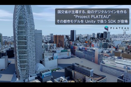
PLATEAU SDK for Unity is an open source toolkit for using PLATEAU within Unity. This SDK allows you to easily develop real-world applications and urban simulations using PLATEAU's rich data.PLATEAU SDK for Unity allows you to easily develop real-world applications and urban simulations using PLATEAU's rich geospatial data.The Asset Store provides a stable official version, but Github allows you to try out the latest alpha and beta versions as soon as possible.If you are interested in new features and features in development, please check out our Github repository. Please give us your feedback and we will reflect it in future development.Also try the latest version on Github.NoticeCurrently, this SDK and documents are only available in Japanese language.User Manualhttps://project-plateau.github.io/PLATEAU-SDK-for-Unity/Tutorialhttps://www.mlit.go.jp/plateau/learning/tpc17-1/PLATEAU SDK-Toolkits for UnityWe are excited to announce the release of the "PLATEAU SDK-Toolkits for Unity," a set of toolkits designed to support application development on Unity using 3D city models.The PLATEAU SDK-Toolkits for Unity is an add-on that requires the PLATEAU SDK for Unity, so make sure to use them together.You can access the PLATEAU SDK-Toolkits for Unity repository here:https://github.com/Project-PLATEAU/PLATEAU-SDK-Toolkits-for-UnityIntuitive CityGML ImportThe City Model Import function allows you to import all 3D city model data that conforms to PLATEAU's 3D City Model Standard Product Specification (2nd Edition Series) into your Unity scene as input.The import process follows the flow below.1. File acquisitionThe required CityGML, code list, and texture files are searched and acquired. The source files can be imported not only from locally stored files, but also from the distribution server provided by PLATEAU.2. Extraction of 3D city modelExtracts 3D city models within the coordinate range set during import. The range can be specified by selecting a rectangle using the minimum and maximum coordinate values as input.3. Coordinate Projection to Plane Rectangular CoordinatesSince coordinates in CityGML are stored in latitude and longitude, they are converted to plane rectangular coordinates in order to handle coordinate values in meters in Unity. The coordinates are offset so that each object is displayed near its origin in the Unity scene. The offset value is initialized at the center of the selected range, but it can be rewritten freely.4. Conversion of CityGML geometry data to polygon meshCityGML shape data cannot be visualized in the game engine in its original format, so it is converted to polygon mesh at the time of import. The converted polygon mesh is visualized as a mesh object in the Unity scene. When converting to a polygon mesh, you can select the unit of merging from primary(buildings, roads, etc.), atomic(walls, roof surfaces, etc.), or area(all land objects within a 100m x 100m area are merged).3D City Model AdjustmentYou can adjust the appearance of the 3D city model imported into the scene with the import function. Specifically, each object can be displayed or hidden according to the following settings.- LOD(Level of detail in CityGML)- Feature type (buildings, roads, DEM, etc.)Export of 3D City Models to FBX, OBJ, glTFImported 3D city models can be exported in 3D file formats.- Export to OBJ, FBX, and glTF- Exclusion of objects set to be hidden by the city model adjustment function- Output coordinate system can be selected from Local (coordinates in the Unity scene) and Plane Cartesian (planar Cartesian coordinates)- Output mesh coordinate axis settingsC# API for Accessing Attributes in 3D City ModelsAPIs to access attributes in 3D city models are provided for C# users. The API provides access to all attribute information contained in CityGML. The names of Unity objects in the imported 3D city model correspond to their IDs in CityGML, so you can specify the name of each object to the API to retrieve its associated attribute information.- Ideal for handling CityGML in Unity- Multi-platform support (Windows, macOS, iOS, Android)- Compatible with all CityGML compliant with PLATEAU's 3D City Model Standard Product Specification (2nd edition series)- URP, HDRP and Built-in Rendering Pipeline are supported