



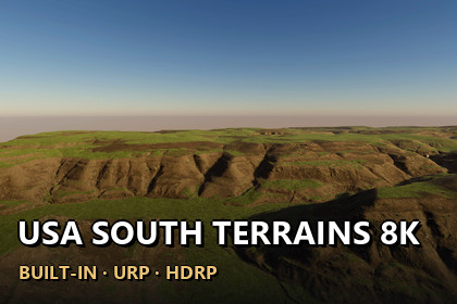
34 real-world LIDAR terrains (Arkansas 19, Alabama 13, Florida 2), 8.128 x 8.128 km each (about 8 x 8 km) at 1 m resolution, true 1:1 scale in Unity. 9 demo scenes, Built-in/URP/HDRP.Unity 2022.3 and above. Built-in, URP and HDRP in one package. Real-scale terrains (1 unit = 1 m) built from the exact heightmap pixels.▶ Full 4K video showcase: https://youtu.be/K-25oLnCVZEOzark hollows, river bluffs and southern lowlands at their real size34 real-world terrains from LIDAR elevation data (Arkansas 19, Alabama 13, Florida 2). Deep Ozark hollows and bluffs from Arkansas, branching valleys and escarpments from Alabama and the flat lowlands of Florida. Every heightmap covers 8.128 x 8.128 km (about 8 x 8 km, 64 square km) with 1 m between samples. Every Unity terrain sample is an original heightmap pixel - nothing is stretched or resampled - and 1 Unity unit is 1 metre.✦ WHAT'S INSIDE34 heightmaps - 16-bit PNG, 8129 x 8129 px, one folder per state, height range from 10.2 m to 425.0 m3 demo levels x 3 render pipelines - 9 ready scenes to fly or walk through: Ozark Hollows, River Bluffs, Escarpment BowlTerrain Builder - one click turns any heightmap into seamless real-scale Unity terrainsUSA ground look - 6 ground layers in 4K made for US forests, farmland and hills (meadow, forest floor, dry earth, scree, rock, gravel), painted automatically from slope and landform✦ FEATURESExact scale - size and height range are in every file name and inside every PNG, and the builder reads them for youAnti-tiling terrain shaders - every layer blends three texture sizes by viewing distance, so no repeating patternsSeamless 2 x 2 tiles - each map is split into four 4097-sample terrains (Unity's limit) that share their edge pixelsLake water - taken from the flat lake surface in the elevation data (River Bluffs demo level)Verify - compares every terrain height with the original pixels✦ PERFORMANCENative 3840 x 2160 - no upscaling, demo scenes in player builds: Built-in 153-176 FPS · URP 220-237 FPS · HDRP 161-186 FPS (RTX 3090)✦ DEMO CONTROLSMouse look · WASD move · Shift fast · G walk at 1.8 m eye height · F fly · N / P next / previous level · H help✦ UNITY 2022.3 AND ABOVEBuilt-in, URP and HDRP in one package. Tools > Lidar Terrains > Project Setup switches on terrain holes in your pipeline asset with one click.✦ USE CASESOpen-world games · flight and driving simulators · hiking and survival games · cinematics · terrain studies. The heightmaps also work in other tools: 16-bit PNG, north up, size and height range in the file name.34 heightmaps, 16-bit greyscale PNG, 8129 x 8129 px, 1 m sample spacing, 8.128 x 8.128 km (about 8 x 8 km, 64 square km) eachHeight range 10.2 m to 425.0 m (lowest point of each map at 0)Unity terrains: 2 x 2 tiles of 4097 samples per map, terrain holes for the exact edge3 demo map prefabs (one prefab works in every pipeline) + 9 demo scenes (3 per pipeline)6 USA ground layers + 6 shared ground layers, 4096 x 4096 albedo, normal and mask texturesAnti-tiling, world-aligned terrain shaders for Built-in, URP and HDRPEditor tools: Terrain Builder, Project Setup, USA Ground Textures; PDF documentation includedUnity 2022.3 and above; Built-in, URP and HDRP