




Real Earth Planet - Real-World Terrain, Roads & Railways Generator
u3d
$59.50
$119.00
50%OFF
(no ratings)
Jump AssetStore
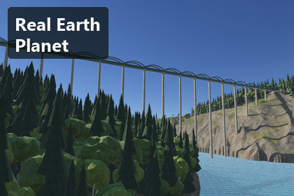
Pick any place on Earth by globe, city or coordinates and build it in Unity: real elevation, OpenStreetMap railways, roads, rivers, forests, seamless neighbour tiles. URP, Unity 6.3.URP only: built and tested on Unity 6000.3.21f1 with URP 17.3 (Universal 3D template). Built-in RP and HDRP are not supported. Terrain Holes must stay enabled in the URP asset (the default) for tunnel mouths.Pick a place on a turning globe — or type a city or a pair of coordinates — and get the real place in Unity: its real terrain at 1 m resolution, its real railway and roads laid with bridges, viaducts and tunnels, its rivers, lakes and forests — fetched and built at runtime, and now with seamless neighbouring tiles around it. For the Universal Render Pipeline (URP) in Unity 6.3 (6000.3.21f1).New in 1.1- Choose the place by city or by coordinates. Search 8 444 cities of 186 countries by name (accents and case ignored, "springfield, il" style filters), or type or paste coordinates in any common format: decimal degrees, degrees-minutes-seconds, hemisphere letters, map links.- English country and city names on the globe. Countries far out, cities by population as you zoom in, never overlapping, never behind the horizon or under a panel.- Seamless neighbouring tiles. Build the 3 × 3 tiles around your place (or any single neighbour): identical heights on every shared edge (measured 0 m on all 12 edges), railways, roads and rivers that continue across the borders, one horizon around the whole area, and a seam report you can check in code.- A redesigned presentation interface. Step bar, explorer with search, coordinates and ready-made places, place card, live progress panel, region controls with layer toggles, a neighbours panel with a 3 × 3 map and "Show seams". One theme file restyles it; two open-licence fonts are included.- Visible generation: elevation tiles rise, the OpenStreetMap lines are drawn and the terrain appears while the place is built.- Smoother cameras for the orbit and the fly-over, and the demo now runs in Play mode inside the Editor as well as in a player.- Configurable terrain resolution per tile (1 m, 2 m or 4 m cells) for smaller machines.Choose a place and press Generate. Real Earth Planet downloads that place's elevation and its OpenStreetMap data on the spot, builds a 2 × 2 km Unity Terrain, plans the railway and the main roads over the real ground with Real Roads & Tracks 1.0 (included), carves the rivers, fills the lakes and plants the forests. Nothing about any place is stored in the package, so the whole planet is available without gigabytes of downloads. A region you built once comes back from the disk cache without the network.Five real places, ready to fly over- Landwasser Viaduct, Switzerland — the Albula line crossing the gorge into the Landwasser tunnel, on 0.5 m swissALTI3D lidar.- Garabit Viaduct, France — the 565 m railway viaduct over the Truyère reservoir and the A75 motorway bridges.- Glenwood Canyon, USA — both I-70 carriageways through the 1.2 km Hanging Lake Tunnel, the Union Pacific line and the Colorado River.- Kalte Rinne, Austria — the Semmering railway over the Kalte Rinne viaduct and through the Polleros tunnel.- Loreley, Germany — both Rhine railways with their tunnels, the B 9 and the Rhine itself.Each place was checked against official point heights and its OpenStreetMap bridges and tunnels. Coordinates within 50 m of one of them open that place with its fly-over. Any other latitude and longitude works too.A globe you can pick from- A turning Earth with day and night maps, city lights, clouds and stars. Hover a country to name it, click to select it, click inside it to choose a place; the region box is drawn to true scale.- One input path for mouse, touch, keyboard and your own code (Input Manager or Input System). uGUI, no IMGUI.Real data, on demand, without keys- Elevation from Mapterhorn terrain tiles: national lidar where it exists (0.5 m in Switzerland, 1 m in the USA, France, Austria and parts of Germany) and the global 30 m Copernicus base elsewhere; AWS Terrain Tiles as the fallback.- Roads, railways, waterways, lakes, forests and bare rock from OpenStreetMap in one Overpass query per tile.- No account, key or token for the defaults. The default public services are meant for evaluation and light use; every endpoint is configurable, so a shipped game uses your own servers.Real terrain, real railways- A 2048 × 2048 m Unity Terrain at 2049² (1 m cells) in an exact local frame: world metres are real metres. A 16 km horizon ring around it.- The railway and the main roads are planned over the real ground by Real Roads & Tracks, held at the heights of the OpenStreetMap bridges and tunnels: viaducts over gorges, tunnels with fitted portals and terrain holes, cuttings and embankments within real grades.- Earthworks capped so fills never wall off a gorge; rivers carved with a downhill-only surface; lakes levelled.- Ground painted from slope, altitude and OpenStreetMap areas by a URP terrain shader built against visible tiling; GPU-instanced forests at real density.Built for your code- Every step is a public C# API; RegionBuilder runs it all as one component and RegionGrid adds the neighbours. The data core, the city search and the coordinate parser are engine-free C#.- Attribution built in: an on-screen credit line and a notices file with the exact credit text for every data source.AI Ready. Built to be driven by AI coding agents as well as by hand. Documentation/SKILL.md gives Claude Code, Codex, Cursor or a Unity MCP bridge the map of the package: RegionBuilder and RegionGrid and their API, the RegionLocations table as plain data, the city search and coordinate parser, how to add places and data providers, and a verification table (centre height, viaduct and tunnel coverage, 0 requests on a warm build, a 0 m seam report), so an agent can build and check a region without guessing.Real Roads & Tracks 1.0 includedThe complete Real Roads & Tracks 1.0 ships inside this package (Assets/RealEarthPlanet/ThirdParty/RealRoadsAndTracks) with its own GUIDs; owners get the same files merged by GUID.Honest limits- Neighbouring tiles cost memory and time: the 3 × 3 example at full 1 m resolution takes about 74–85 s from a warm cache on the reference PC and holds about 0.7 GB in Unity plus 0.7–0.9 GB managed memory; each new tile sends one OpenStreetMap query (minutes on a busy public server). Lower the per-tile resolution (2 m or 4 m cells) on small machines.- No WebGL support in 1.1, and no mobile or console claims.- The public Overpass servers and Mapterhorn's hosted tiles are community services for evaluation and light use; configure your own endpoints for a shipped game (documented).- The city table holds 8 444 cities with English names; smaller towns are reached by coordinates.Data and licences- The package contains no map or elevation data: it is fetched at runtime and stays in the user's cache. Show "© OpenStreetMap contributors" and the elevation credits with any region; the Documentation gives the exact texts and explains the ODbL. Interface fonts: SIL Open Font License 1.1.What is not included- Built-in and HDRP versions.- Metre-gauge and other non-standard gauges: railways are laid at 1.435 m.- Masonry arch bridges: bridges use Real Roads & Tracks' girder, truss and steel-arch styles.- Every road of a region as a built road: the main lines are built, other roads show as clearings.- Satellite imagery, buildings and traffic.SupportQuestions and bug reports: Unity Discussions or cgteamorg@gmail.com. Please include your Unity version and the latitude and longitude of the region.If Real Earth Planet helps your project, a rating on the Asset Store helps other developers find it. It is optional, and nothing depends on it.Credits for the media on this pageMap data © OpenStreetMap contributors (openstreetmap.org/copyright). Elevation © Mapterhorn (mapterhorn.com/attribution) and its sources: © swisstopo (swissALTI3D); Source: IGN – RGE ALTI® / MNT LiDAR HD (accessed 2025–2026); Elevation: USGS 3DEP, courtesy of the U.S. Geological Survey; © BEV (ALS-DGM), CC BY 4.0; © GeoBasis-DE / LVermGeoRP 2025, dl-de/by-2-0; horizon: Copernicus WorldDEM-30 © DLR e.V. 2010-2014 and © Airbus Defence and Space GmbH 2014-2018, provided under COPERNICUS by the EU and ESA. Star field: NASA/Goddard Space Flight Center Scientific Visualization Studio. See Documentation/THIRD-PARTY-NOTICES.md.More from this family- Real Roads & Tracks — procedural roads, railways and roller coasters (included here): https://assetstore.unity.com/packages/slug/411734- Geopolitical Earth Planet — the political globe with nine data layers: https://assetstore.unity.com/packages/3d/environments/geopolitical-earth-planet-189702- Built and tested on Unity 6000.3.21f1 with URP 17.3, and URP only: Built-in RP and HDRP are not supported.- Tested on Windows desktop (Editor Play mode and player, D3D12). WebGL is not supported in 1.1. No mobile or console claims.- Needs internet access when a region is built (Editor or player). Cached regions build offline.- Per region (one tile): about 8 MB of downloads and cache (30–36 detailed tiles, 16 ring tiles, one map answer of about 0.8 MB).- 3 × 3 tiles at 1 m: 74–85 s from a warm cache; about 0.7 GB Unity + 0.7–0.9 GB managed memory; 2 m / 4 m cells: about 0.5 / 0.43 GB.- Measured on the reference PC (RTX 4090, 1920 × 1080, MSAA 4×): rails plan 6.5 s, terrain fit 2.3 s, ground and water 1.4 s for the Landwasser region; 20–38 ms per frame with 63 000–163 000 trees and the water, including a GPU read-back.- Terrain Holes must be enabled in the URP asset (the default) for tunnel mouths.- Input: legacy Input Manager, Input System or Both. uGUI interface, no EventSystem or TextMeshPro needed.- City table: 8 444 cities (English names), 0.4 MB, searched locally.AI was used as a development aid; no AI-generated image, texture, mesh, font or audio is shipped in this package.- Code and documentation: written with AI coding assistants and reviewed and tested by the publisher (engine-free core tests with golden decoder comparisons and 121 search/coordinate tests, runtime checks against official survey heights, seam measurements, in-Unity player runs, Unity's Asset Store validator).- Globe content and the city table: from the publisher's own asset Geopolitical Earth Planet; not AI-generated.- Interface fonts: Oswald and Source Sans Pro, unmodified, SIL Open Font License 1.1.- Terrain, roads, railways, water and forests are built at runtime by the package's own code from open data fetched on the user's machine.- Included Real Roads & Tracks: see its own declaration (procedural textures and meshes; image models were used only for concept references during its development and nothing of that is included).- The store screenshots and videos are recordings of the package running (the player and the Unity Editor), with captions added; no image model was used for them.